This week we release a new update to the Newtracs mobile app on Android & iOS. The update offers exciting new features and overall performance enhancements.
New ‘Active Trail Feedback’ feature
Since its inception, the Newtracs platform has worked to constantly update and maintain 4WD trail condition information automatically by analysing a user’s 4WD journey along a trail.
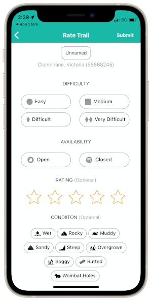
Our new Active Trail Feedback feature allows users to actively submit feedback on trail conditions including difficulty rating, current closure status, and star rating. Users can also call out condition information via preset flags such as rocky, muddy or overgrown. Where a trail is currently unnamed, a user can submit a correction to the name and also provide free text comments for additional info.
Active Trail Feedback submissions are moderated to ensure the feature is not abused. Ultimately Active Trail Feedback seeks to improve the level of information available to 4WDers when exploring the bush, and improve the accuracy of the Newtracs trail assessment algorithm.
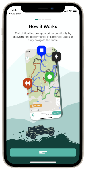
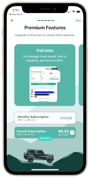
New user onboarding screens
We have introduced new user onboarding walkthrough section to highlight key features of the Newtracs platform. The walkthrough includes sections on how the platform works, how to log trips, how to download offline maps, and how to complete a vehicle profile.
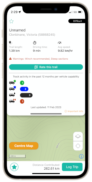
In addition, we have included a section to highlight the benefits of Newtracs Premium membership which provides access to additional data layers in-app including:
- location of obstacles and difficult sections
- detailed track stats including time to complete and average travel speed
- recent traffic information showing number of vehicles that recently visited the trail by vehicle class and the date of the most recent visit
- access to topographic map layers including hillshade and contour lines
- access to closed trail and snowline layers (Vic only)
Updated offline map packages
Offline map packages have been updated incorporating updates to our basemap data from OpenStreetMap. This incorporates updates to road geometries, and new additions to the road network.
To update your offline map pack, first delete and re-download as follows:
- In the Newtracs app, navigate to Account > Offline Maps. Ensure you are connected to a fast stable internet connection (e.g. Wifi at home).
- Delete any offline package already installed by tapping Delete
- Download the same package again by tapping Dowload.
Performance enhancements
We have also included significant performance enhancements and bug fixes. For example, users with many pins previously experienced lagging and overall performance issues which have now been resolved in the latest version.