Top 9 Most Popular Victorian 4WD Tracks
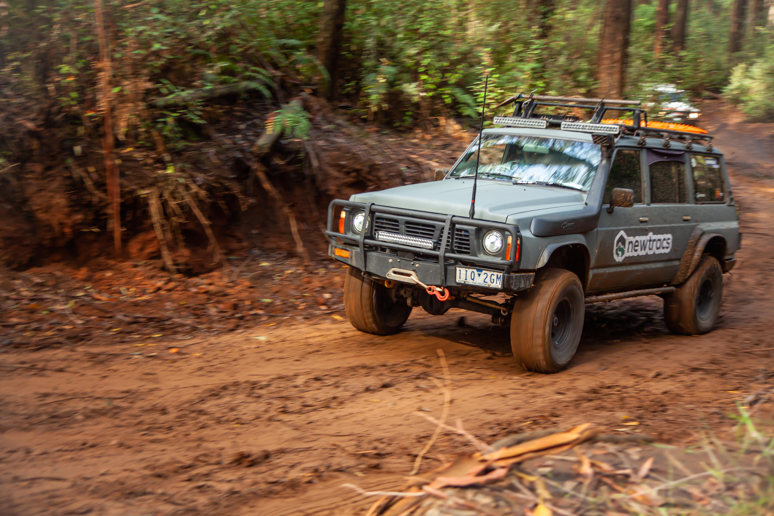
Four-wheel driving in Victoria offers enthusiasts a thrilling adventure through diverse landscapes, rugged mountain ranges, coastal rainforests, and expansive deserts. On offer is an extensive network of 4×4 tracks covering vast areas of park and forest landscapes across the state.
Here are the top 9 most popular 4wd tracks based on trips conducted by Newtracs users.
- Crooked River Track
- Billy Goat Bluff Track
- Bluff Track
- Blue Rag Range Track
- Zeka Spur Track
- Burgoyne’s Track
- Mount Terrible Track
- Luke Creek No. 2 Track
- Aeroplane Track
1. Crooked River Track
Location: Wongungarra
Difficulty Level: Medium
Track ID: 319807365
See it on the Newtracs map: Go to map
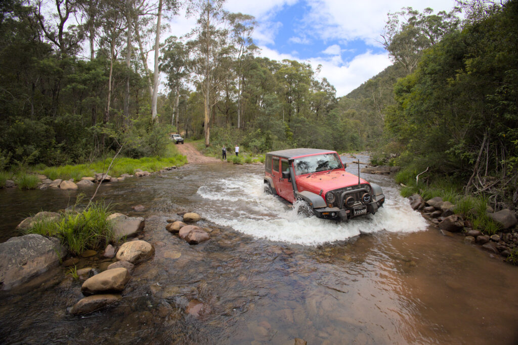
Crooked River Track is situated in the Victorian High Country, a renowned 4WDing destination known for its diverse and challenging terrain. The track is characterised by a mix of rugged, rocky paths, steep ascents and descents, and numerous exciting crossings of the Crooked River.
One of the highlights of 4WDing on this track is the breathtaking scenery. As you navigate through the challenging terrain, you are rewarded with stunning vistas of the surrounding High Country landscape, including lush forests, picturesque valleys, and the meandering Crooked River.

What to See: Enjoy panoramic views of the Victorian High Country, and numerous exciting river crossings of the beautiful Crooked River, which meanders through the landscape. Having a snorkel equipped is essential for this track.
2. Billy Goat Bluff Track
Location: Miowera
Difficulty Level: Difficult
Track ID: 122002996
See it on the Newtracs map: Go to map
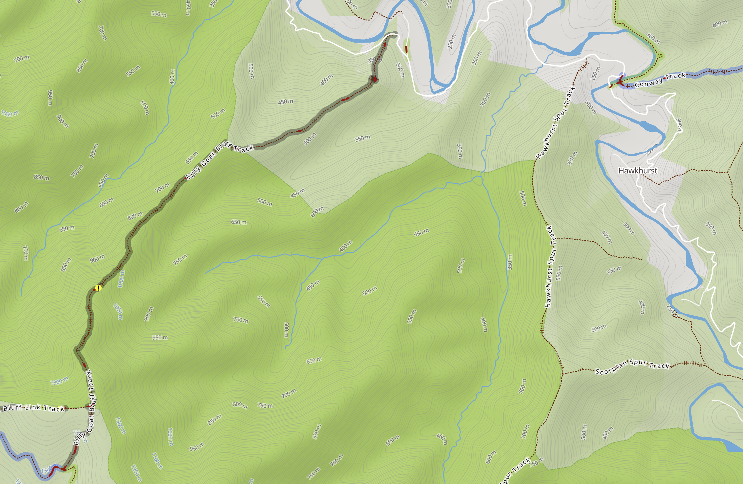
Billy Goat Bluff Track is situated in the Alpine National Park in Victoria’s High Country, a steep, rocky track that demands precise and skilled driving to navigate safely. Off-roading here is extremely challenging, and requires advanced 4WDing skills and a capable off-road vehicle. Despite the demanding nature of the track, it still rewards 4WD enthusiasts with breathtaking and awe-inspiring vistas of the High Country.
What to See: Incredible vistas of the Victorian High Country, whilst navigating one of the steepest 4wd tracks in Australia. Additionally, the area is home to various bird species, kangaroos, wallabies, and other Australian wildlife.
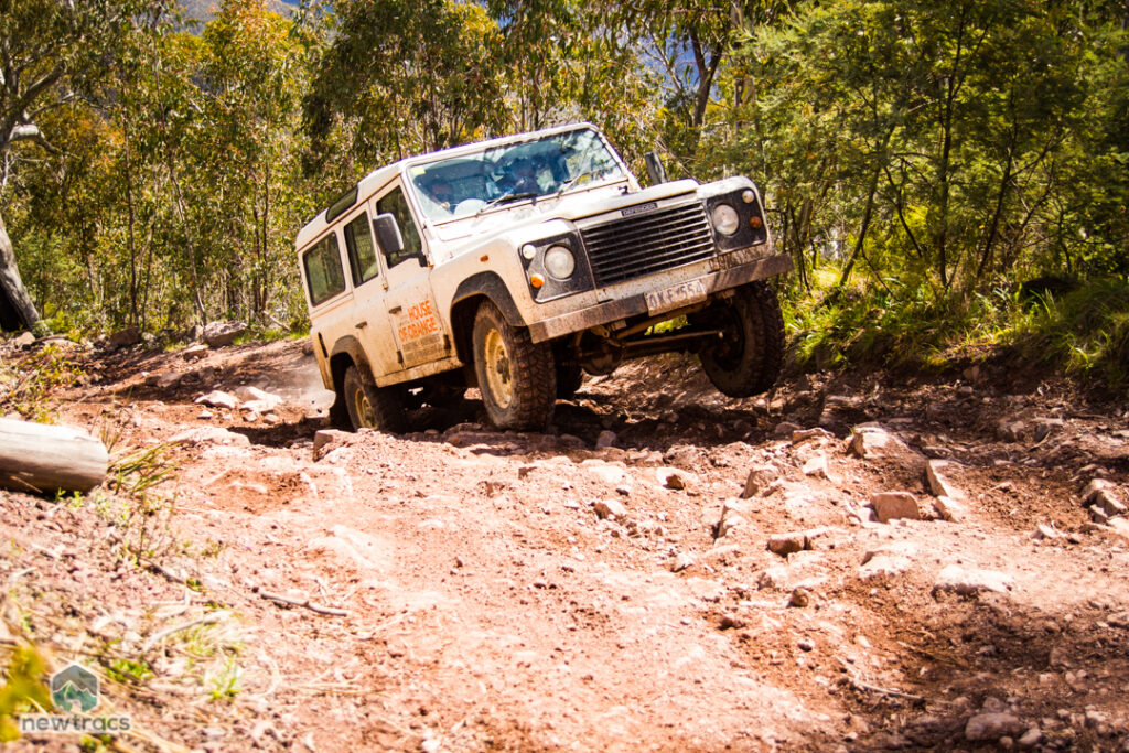
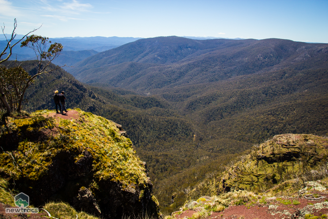
3. Bluff Track
Location: Mount Buller
Difficulty Level: Difficult
Track ID: 41848205
See it on the Newtracs map: Go to map
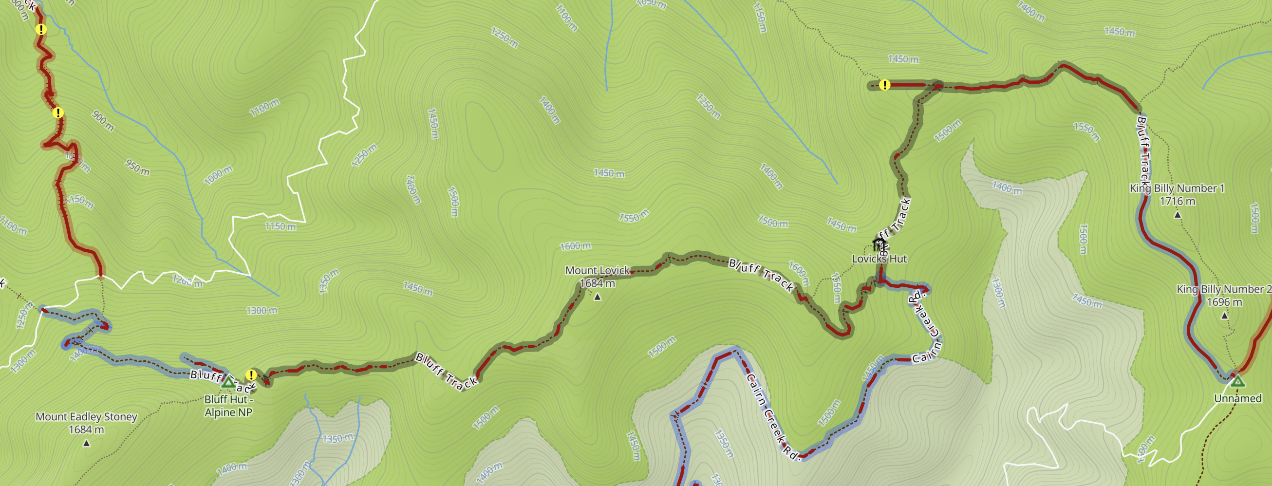
Bluff Track is known for its challenging terrain, which can vary from rocky sections to muddy tracks, steep ascents and descents, and creek crossings. As a result, it’s a great destination for experienced 4WDers looking for a thrill. However, be sure to check track conditions during the winter months, as the track can be covered in snow, making it inaccessible or extremely challenging.
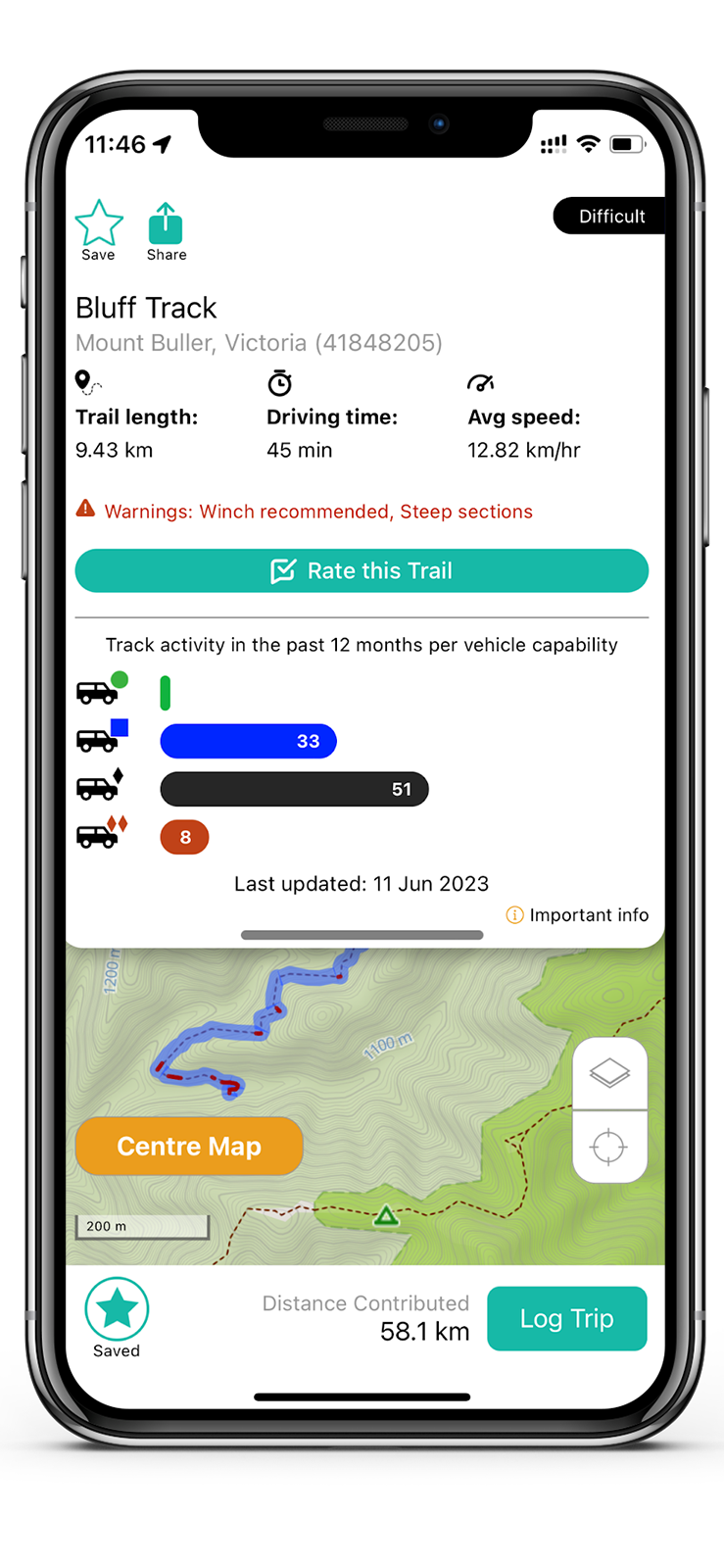
What to See: Explore places like Corn Hill, which offers a challenging ascent and descent for drivers, and also Bluff Hut & Lovick Hut which are an iconic landmarks along the track.
4. Blue Rag Range Track
Location: Selwyn
Difficulty Level: Very Difficult
Track ID: 180909243
See it on the Newtracs app: Go to map
This track is considered one of the most iconic 4WD tracks in the region, offering a thrilling adventure for off-road enthusiasts.
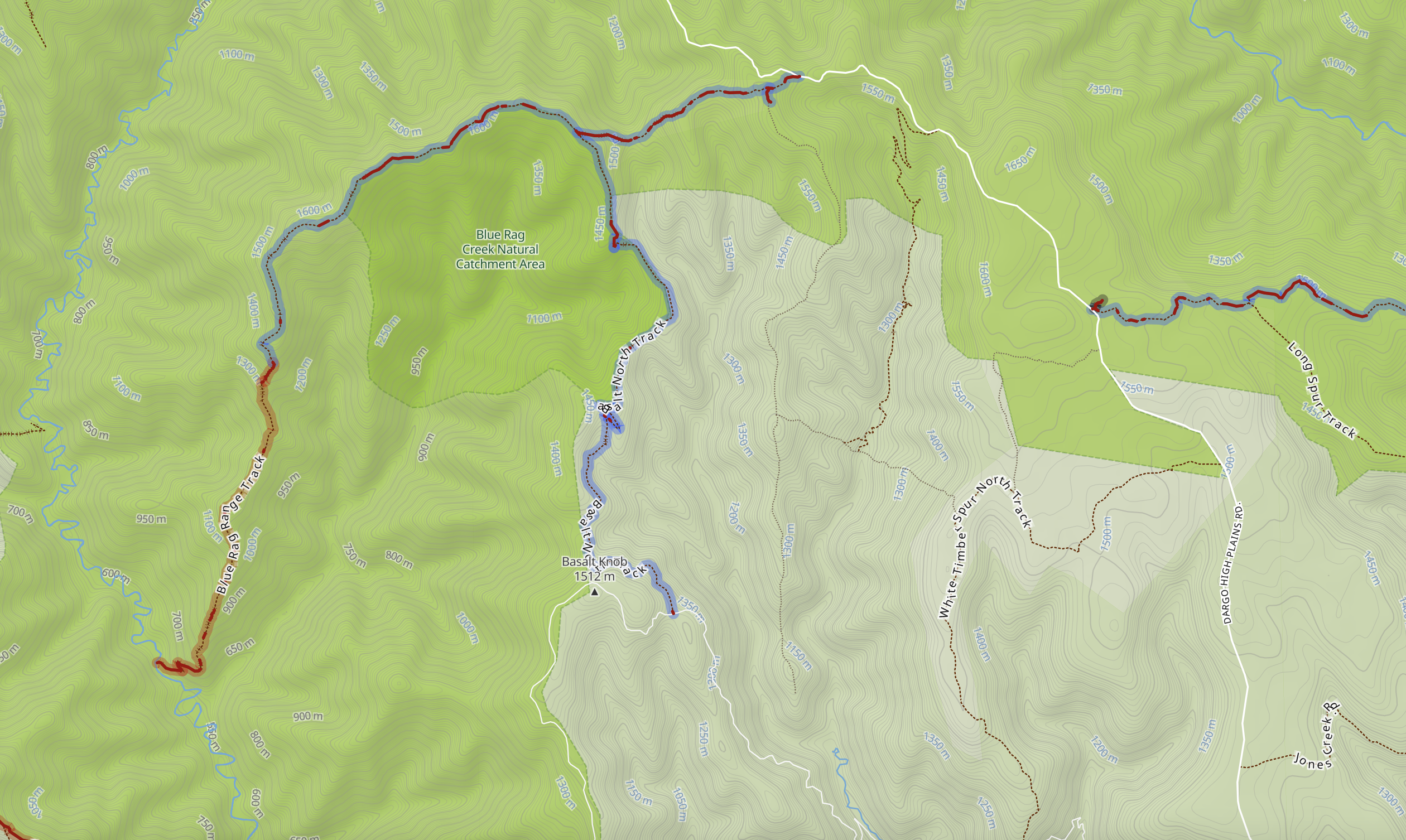
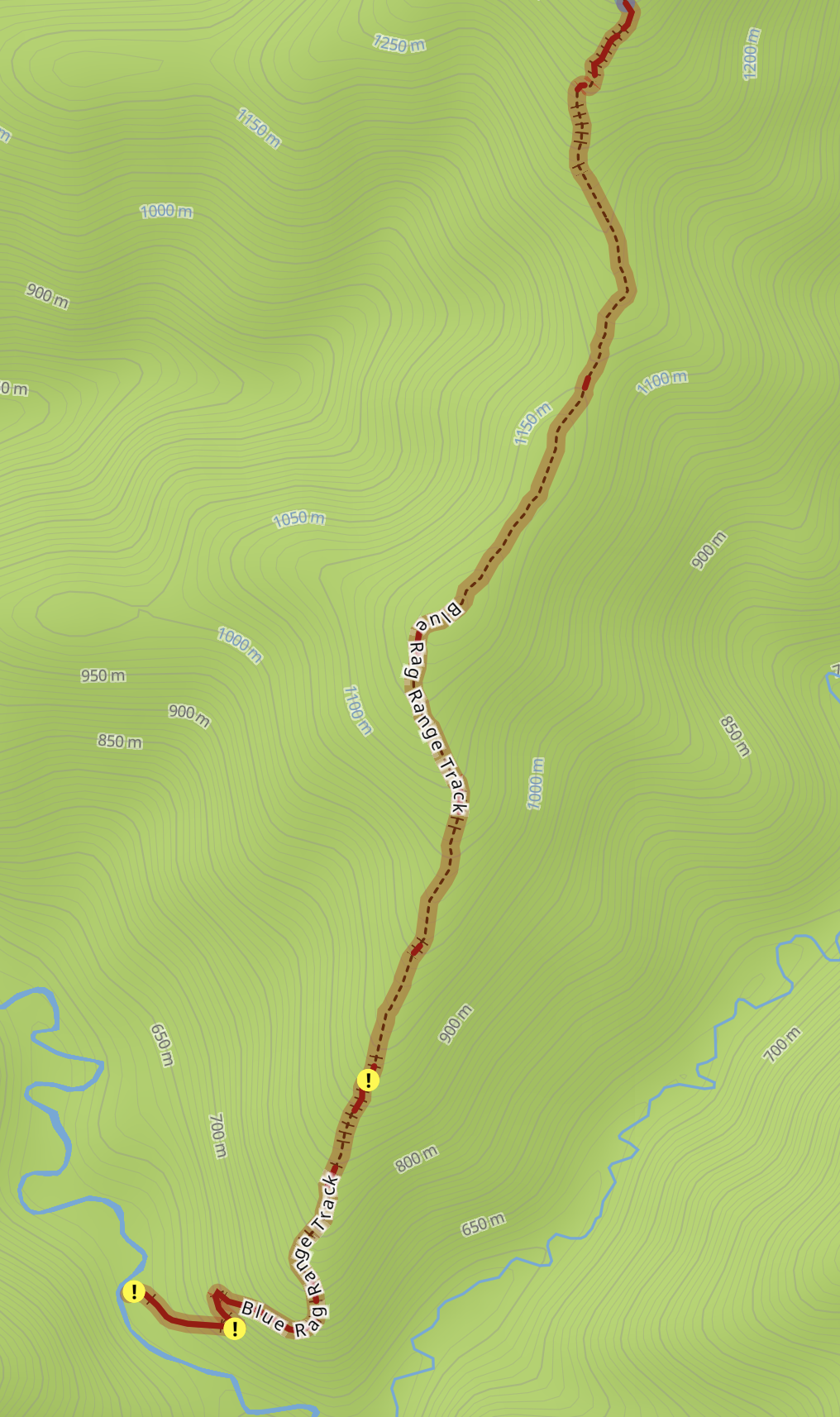
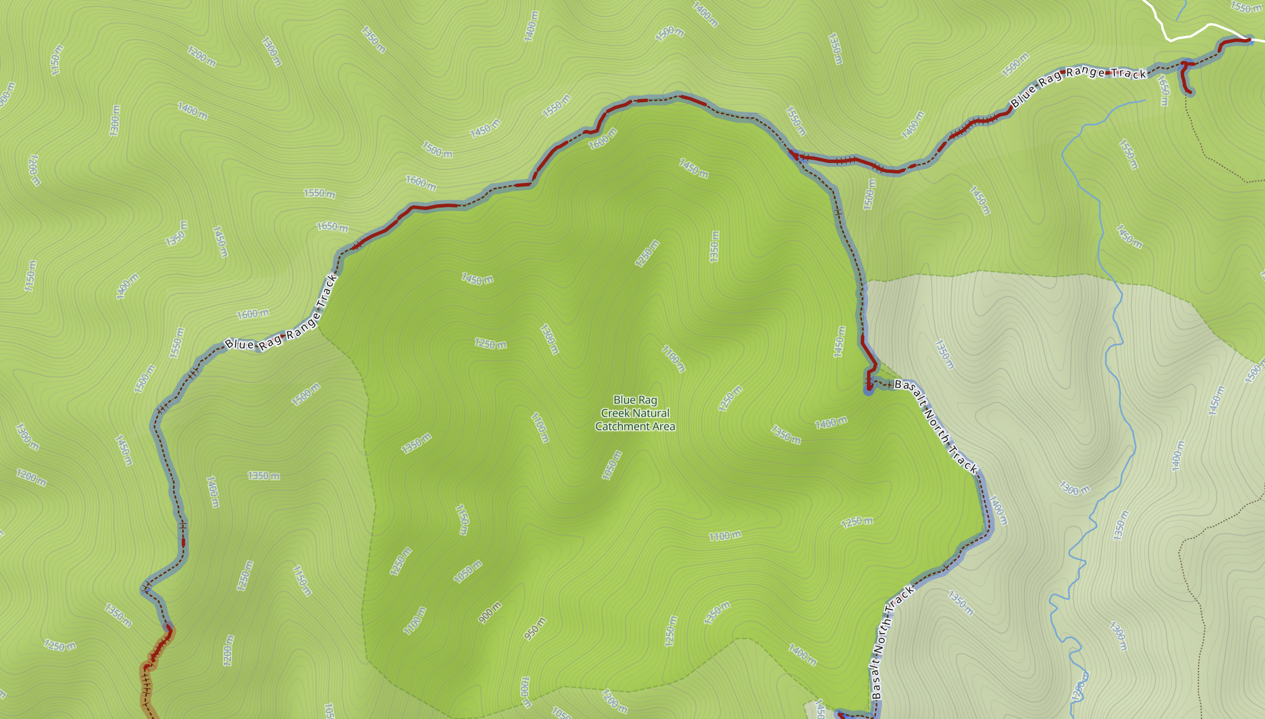
Blue Rag Range Track offers significant elevation changes, taking you to high-altitude areas with stunning panoramic views. The track climbs to over 1,300 meters above sea level, providing a bird’s-eye view of the surrounding landscapes.
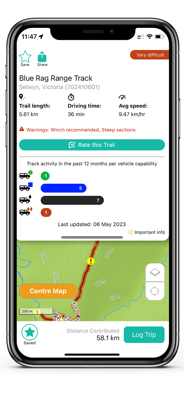
What to See: Panoramic views of the Victorian High Country and some challenging steep sections at the southern section of track. While not directly on Blue Rag Range Track, it is near the iconic Craig’s Hut. It’s a short drive from the track and offers a glimpse into Australia’s alpine history.
5. Zeka Spur Track
Location: Billabong
Difficulty Level: Medium
Track ID: 41848631
See it on the Newtracs app: Go to map
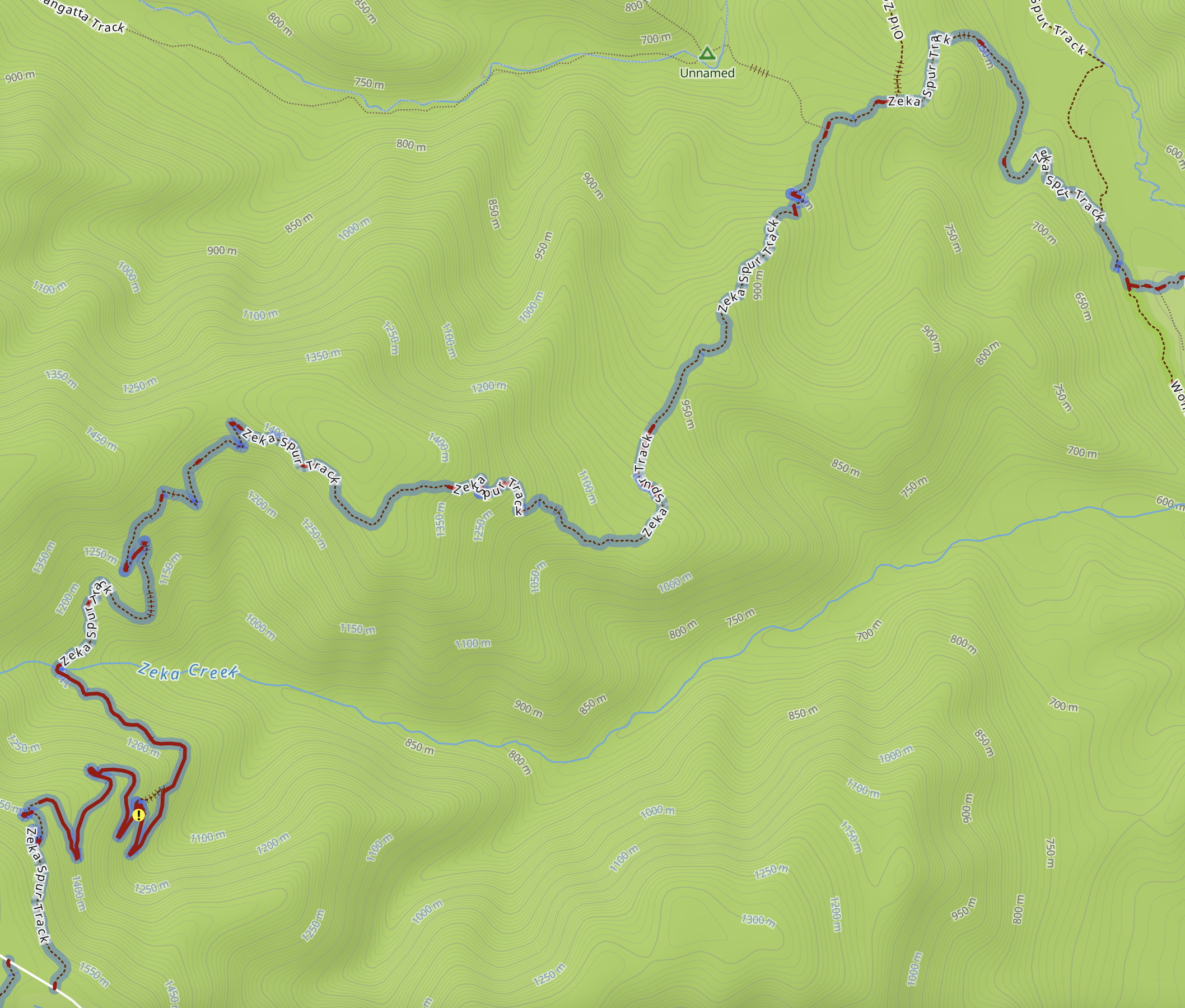
Snaking down to Zeka Creek and back up, this track is known for its technical challenges – offering changing terrain that demands the expertise of experienced 4WDers. Zeka Spur Track presents steep ascents, descents, rocky sections, tight turns, and potentially muddy or slippery paths, providing an adrenaline-pumping and skill-testing drive.
What to See: Explore nearby 4WD tracks or attractions such as the Wonnangatta Valley, Grant Historic Area, or the Crooked River. And get to enjoy panoramic views of the surrounding alpine landscape from the Zeka Spur Lookout.
6. Burgoyne Track
Location: Glenmaggie
Difficulty Level: Medium
Track ID: 153529785
See it on the Newtracs map: Go to map
Burgoyne Track offers 4wding typical of the surrounding Licola region, including steep rocky ascents through dense forests, rocky riverbeds, and mud after rain. Come here to find secluded riverside campsites along the MacAlister River in the valley at the end of the track after a challenging day of 4wding.
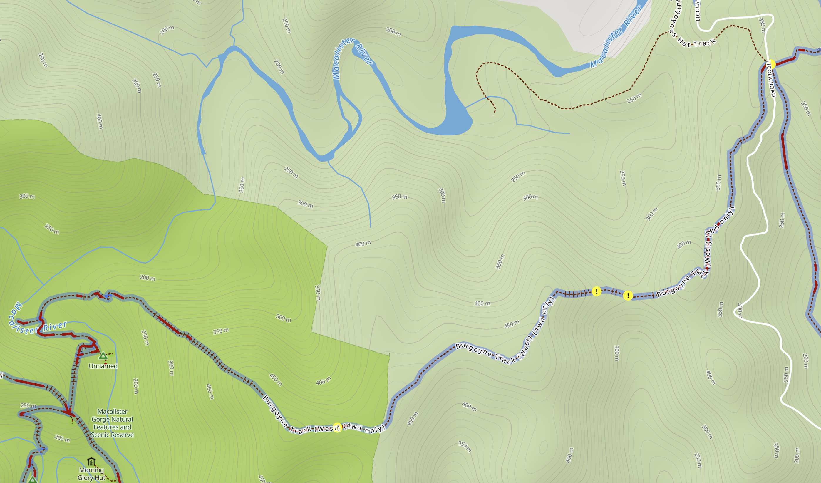
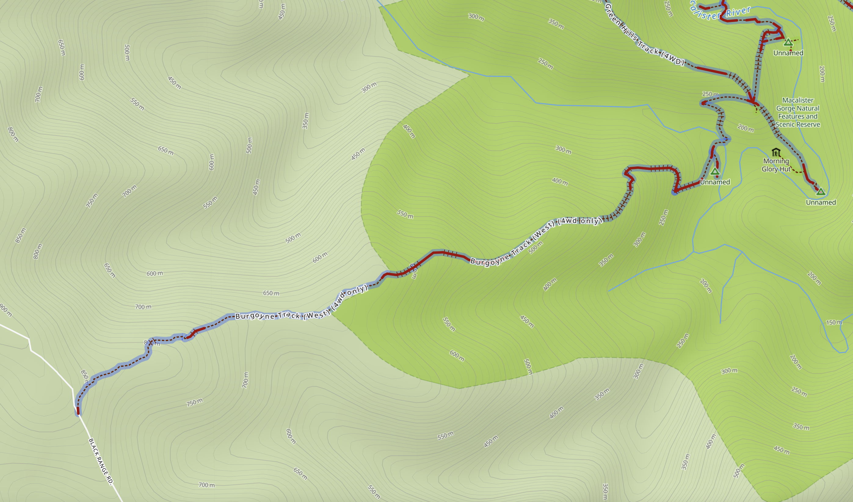
What to see: Picturesque Victorian High Country landscapes and isolated riverside campsites.
7. Mount Terrible Track
Location: Knockwood
Difficulty Level: Medium
Track ID: 212558723
See it on the Newtracs map: Go to map

Mount Terrible Track is a playground of extremes, with its steep ascents and descents, rocky sections, muddy patches, and tight, winding tracks that will test your skills. As the track climbs up Mount Terrible, it features significant elevation changes. The varying altitudes provide not only stunning views but also challenging inclines and offshoots. In the winter, chances of driving through snow along Mount Terrible Track are high, adding to the thrill.
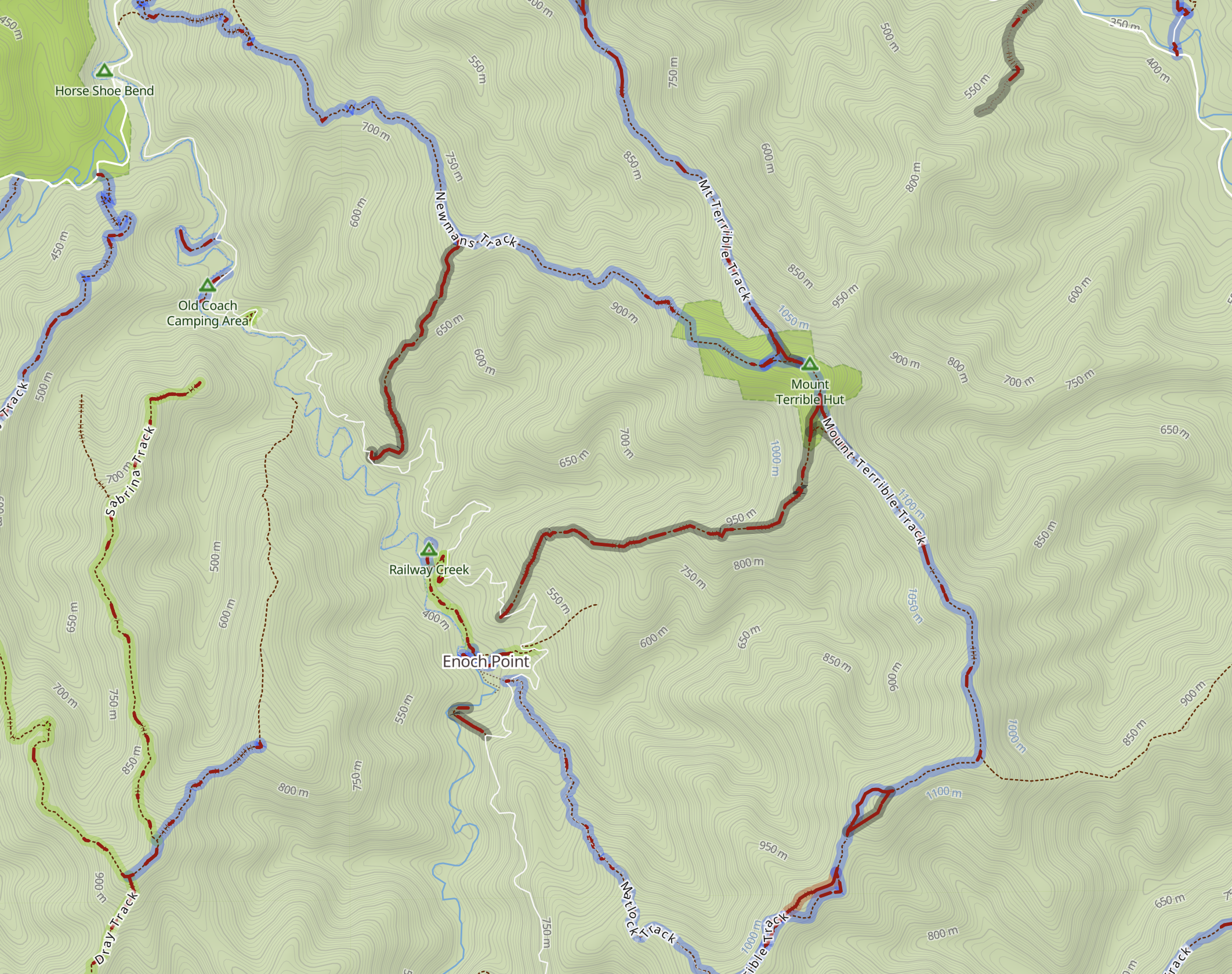
What to See: Conquer the heights and reach the Mount Terrible summit for breathtaking panoramic views of the surrounding alpine landscape. Take time to explore the unique rock formations that adorn the landscape. The rocky sections are not only a challenge for off-roading but also showcase the geological diversity of the region. Winter-time fun a plus whilst driving through snow.
8. Luke Creek No 2 Track
Location: Glenburn
Difficulty Level: Very Difficult
Track ID: 666011424
See it on the Newtracs app: Go to map
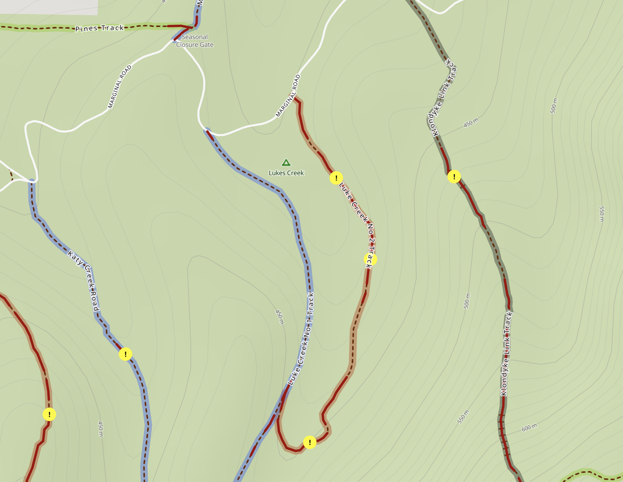
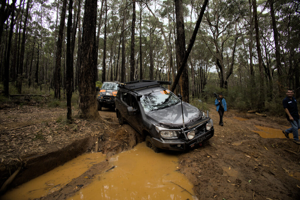
Luke Creek No. 2 Track is quintessential Toolangi, offering slippery, deep bog holes and creek crossings in a picturesque lush temperate rainforest setting.
Multiple chicken tracks allow Luke Creek to be tackled by a range of vehicle setups and experience levels, but be warned: it will be messy, especially after rain.
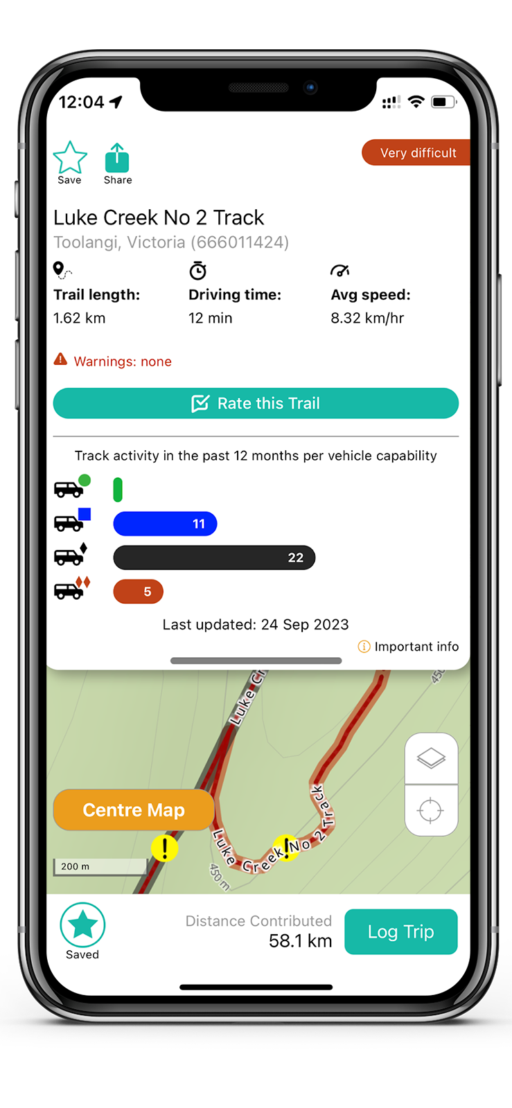
What to see: Breathtaking views of lush eucalyptus forests, fern-filled gullies, pristine creeks and muddy bog holes.
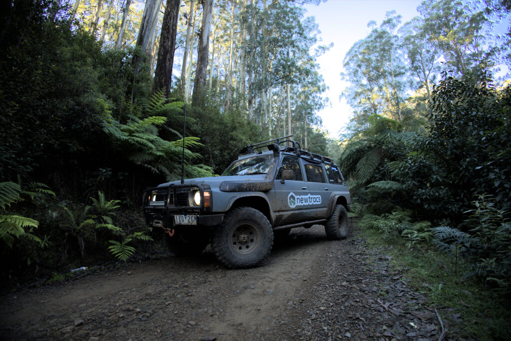
9. Aeroplane Track
Location: Toolangi
Difficulty Level: Difficult
Track ID: 346571211
See it on the Newtracs map: Go to map
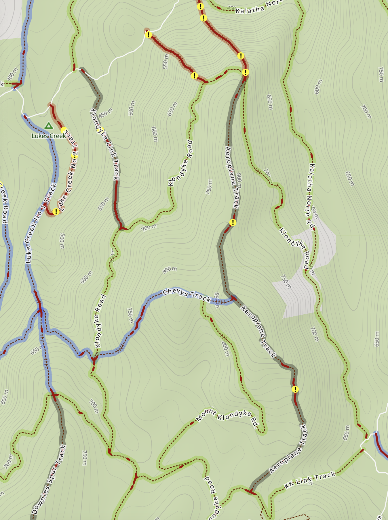
Notice its vicinity to Luke Creek No. 2, to the west.
slippery terrain, to get enough momentum to clear steep sections.
Aeroplane Track is renowned for its exciting and varied landscape, providing an exhilarating 4WD adventure. The track features narrow and twisting paths, and sections that become slippery after rain due to greasy clay-based soil. This diverse terrain pushes the abilities and expertise of 4WD enthusiasts to the limit.
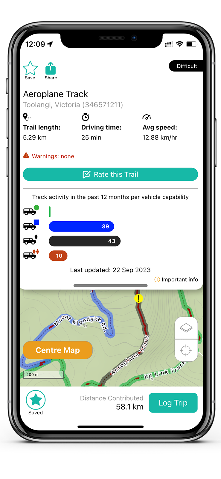
What to See: The Aeroplane Hill is a prominent landmark along the track, providing a great vantage point to take in the surrounding landscapes. The hill offers panoramic views of the alpine region and is a must-see spot.
Final Thoughts
The above 4×4 tracks offer a diverse range of experiences, allowing enthusiasts to connect with nature and push the boundaries of their off-roading skills.
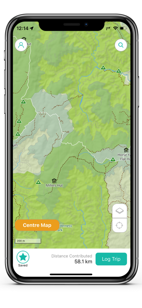
Discover these tracks and more via the free Newtracs 4×4 maps app, available for download on the Apple App Store and Google Play. Downloading Newtracs will ensure you always get the latest track conditions info, as 4wd track difficulty can vary with weather and recent track traffic. Be sure to upgrade to Newtracs Premium in app to get access to more detailed track info including recent track traffic, topographic map info, location of obstacles, plus road closures and snow line layers feature (useful during winter).
Download the Newtracs today on iOS and Android and start your 4×4 adventures!